
The alpine group Corvi di Mandello proposes
RONDO’ DELLE CRESTE
Three days in paradise
dawned 18/12/2010
Each year I like to retrace the "Rondò delle creste" in the group of Grigne
which is almost entirely in common Mandello del Lario where I am born, and where I
live.
Few know and do to this whole path that I believe very impressive because it
runs completely on the ridges of Grigne watershed.
It is interesting for experts and not experts.
If done in full, presents some difficulty mountaineering, but it is possible for the less experienced to
trick he most challenging parts give up parts of the ridge
itself.
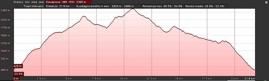
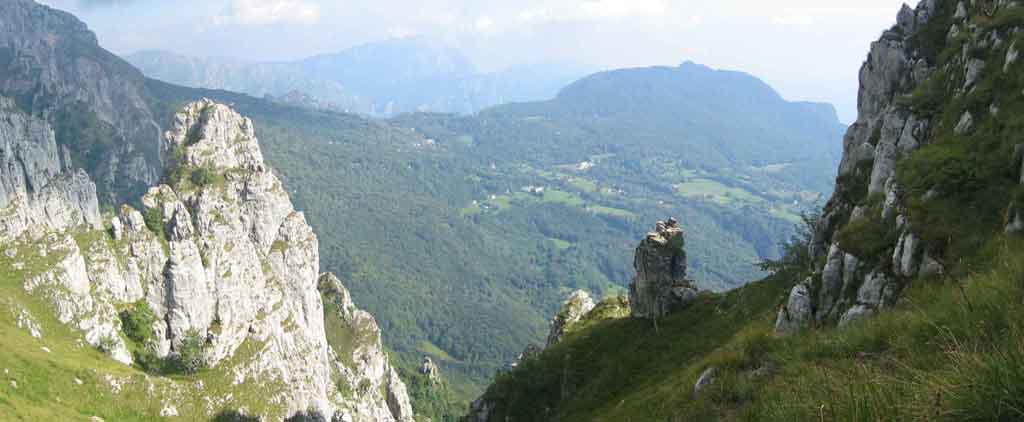
The trek is about 24 km long with gradients on the climbs of about 3000 meters
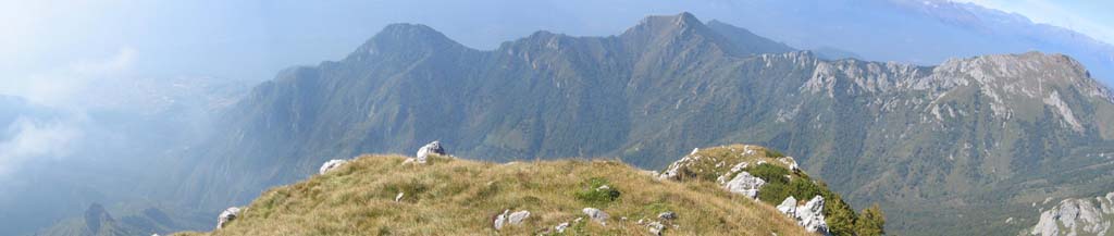
and the same for downhill and advice to do it in three days. (Photo 1)
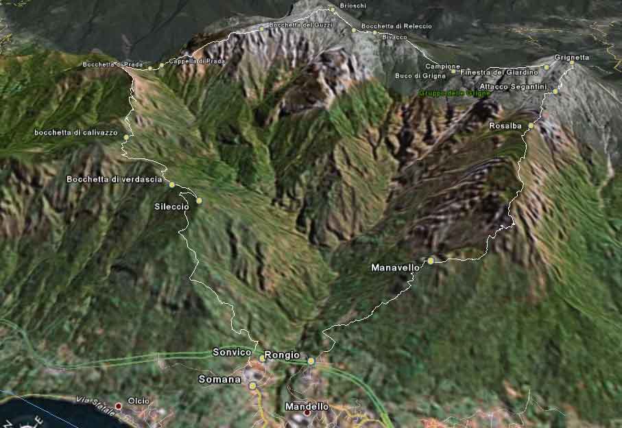 photo 1
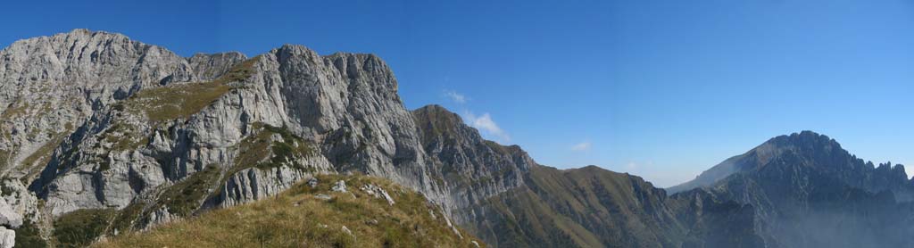
Panoramic of the feature from Rongio of Mandello del Lario to the summit of the southern Grigna (Grignetta) that is:
Crest of Piazzola - Crest of the Pertusio - Segantini Crest
 photo 2
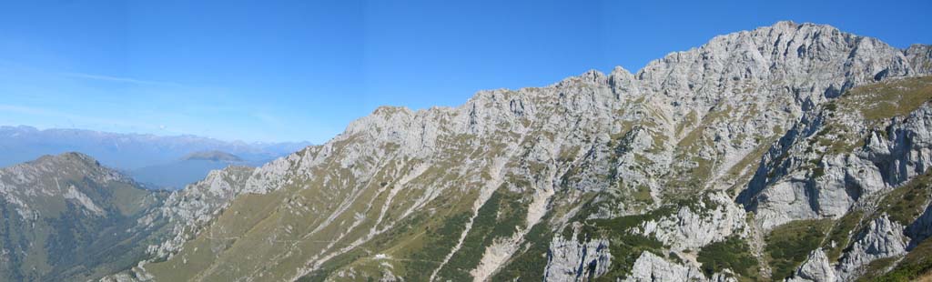
Panoramic of the feature from the southern Grigna (Grignetta) to the northern Grigna (Grignone) that is:
Traversata Alta
 hoto 3
Panoramic of the feature from the Grignone to the blower of Prada that is:
Crest of Piancaformia.
 photo
4
photo
4
Panoramic from the blower of Prada to Somana of Mandello del Lario that is:
Crests of the mount Pilastro, the Grottoni, the top of Enghen, the Tagliata one and the Sileccio.
 photo
5
photo
5
DESCRIPTION
Since the departure is from Rongio and the arrival is to Somana (both fractions of Mandello), is opportune to carry an automobile to Somana for re-enters to Rongio. It is possible in about twenty minutes to go by foot from Somana to Rongio crossing the river Meria.
First feature (crest of Piazzola, crest of Manavello, crest of the Pertusio)
The time of distance is of 4-5 hours
the unevenness of approximately 1300 meters
the development of approximately 5 Km
The departure is from the fraction of Rongio of Mandello of the Lario. (N45 55 39,4 E9 19 49,7 - 403 m above sea level)
It is not necessary to leave soon.
A carrareccia-path is covered for a short feature 13 (photos 6) until a clear turn right in proximity of an aqueduct tank. (N45 55 42,1 E9 20 04,3 - 478 m above sea level)
 photo 6
  photo 7
You turns to the right for a path signalled by a trail sign (Manavello) and laughed them the crinale of Valbiga till to cross a path (N45 55 34,6 E9 20 14,4 - 576 m above sea level); continue rights and cover all the coast dictates of Piazzola.
Continue then till baitello of Manavello (2 hours from Rongio) (N45 55 21,7 E9 20 47,2 - 1046 m above sea level) where he is due to carry out pauses to refresh and enjoying a mozzafiato panorama. (photo 7)
Resume the climb always for the path 13b along the crest of Manavello till the bocchetta of Portorella; a trail sign indicates the path for the Rosalba shelter not always obvious, but always much steep and marked from yellow stamps and with a short equipped feature.
Joints under Zucco Pertusio a path more comfortable bypass the cliffs more impervious and, nearly level, covers all the crest of the Pertusio with exceptional panoramas on Lecco, the lake, the Brianza to right (photo the 8-9) and feature of crest north-western on the left. (photo 10)
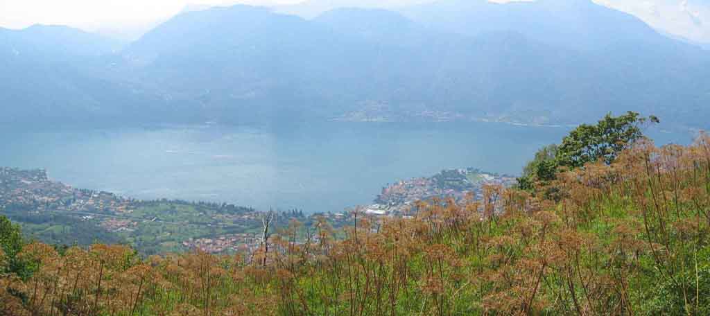 photo 8
 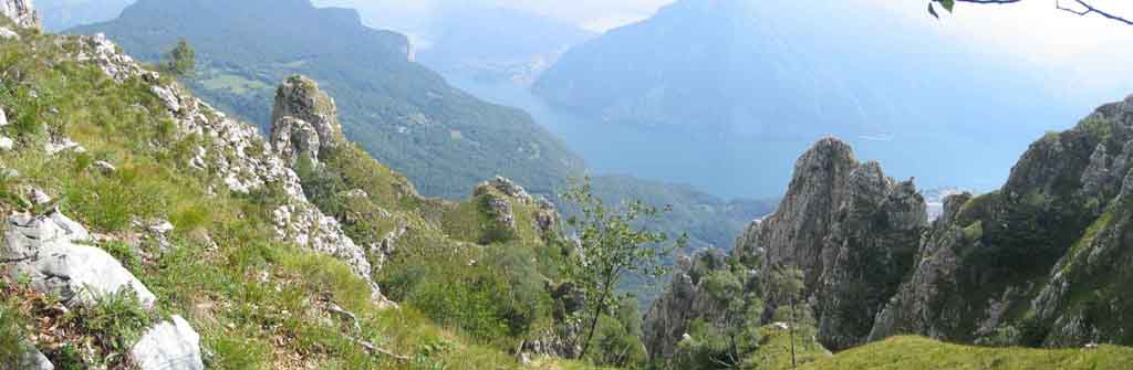 photo 9
 photo 10
Reach the shelter Rosalba destination of the first one covers (N45 55 19,9 E9 22 34,4 - 1707 m above sea level). (photo 11)
 photo
11
photo
11  photo 12
The shelter, managed from Mauro, is very pleasant, equipped of all the equipments for confort and with optimal meal and the abundant.
Near the shelter the first imposing steeples of the Southern Grigna offer the possibility of alpine ascensions of every degree of difficulty in atmosphere of great fascination. (photo 12)
Towards south we enjoy the panorama the Resinelli Plans and, in depth the Brianza and the Milan lands. (photo 13)
 photo
13
photo
13  photo
14
photo
14
To north we see the solid imposing of the Grignone with the Sasso Cavallo and the Sasso dei Carbonari. (photo 14)
Second feature (Segantini crest, Traversata alta)
Time of distance total of second feature 6-8 hours for an unevenness of 700 meters and a development of approximately 7 km.
In the early morning (8-8,30) walking to the obvious ridge following trail sign the 8 for the Crest Segantini-Path Cecilia till the crossroad (N45 55 19,0 E9 23 05,0 - 1880 m above sea level) exactly for the Segantini Crest or the Cecilia path. (photo 15)
 photo 15
 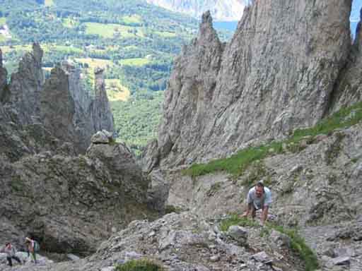 photo 16
Time of distance 45 minuteren approximately.
Most expert they will continue in rope for the wonderful Segantini crest and less expert they will continue equally for the fascinating Cecilia path.
Segantini crest
It introduces some passages of IV degree, for the rest it is a theory of latchs always on cliff of II and III degree that it then begins on the Dorn tower with a jump of IV degree and continues on the Window, the fireplace said of the Swisses and after a crossing on the slope north laughed them the Language for slope then to a carving from which part the last wall.
A short and easy crest conducts then in summit to the Southern Grigna. (N45 55 18,6 E9 23 25,7 - 2174 m above sea level)
It needs an adapted equipment: harness, rope, helmet and shackles.
In the most exposed points there are present nail for the emergency.
Time of distance 2-3 hours.
Cecilia path
To Segantini-Cecilia crossroad is taken to right and the trail sign (10) is followed that passes in the middle of a myriad of steeples (Angelina, Teresita, Clerici and the steeples of the val Tesa with the very famous Fungo) passing to south to the feet of the Segantini crest till to go up a steep coast that conducts to the high part of the Cermenati crest and therefore for path 7 in summit to the southern Grigna. (photo 16) (N45 55 18,6 E9 23 25,7 - 2174 m above sea level)
Time of distance 1,30-2 hours
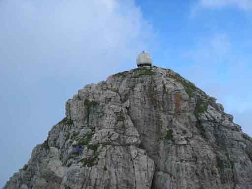
On the summit of the Grignetta there is igloo - bivouac Ferrari. (photo 17)
An other wonderful and long crest attends us that ago watersheds between the Meria river valley, on the left and that of the Pioverna river in Valsassina, to right. It is the "Traversata alta" from the summit of the Southern Grigna (Grignetta) to the summit of the northern Grigna (Grignone).
The trail sign it is the n. 7 till the Merlini bivouac and then the 33.
It is come down behind the igloo for cliffs equipped till the beginning of a little channel also it equipped (Federation N45 55 20,8 E9 23 30,3 - 2150m above sea level) that conducts to the Window of the Garden (N45 55 27,8 E9 23 23,2 - 2006 m above sea level) and then with a flat path between smelling mogo pines to the Campione blower. (photo 18-19) (N45 55 59,6 E9 23 15,5 - 1843 m above sea level)
 photo
17
photo
17 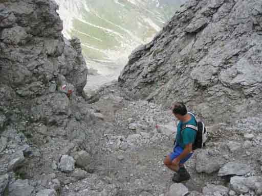 photo 18
  photo 19
The panoramas are indescribable
Come down to the Buco di Grigna (N45 56 06,4 E9 23 15,6 - 1785 m above sea level) laughed them a first full of rocks shield equipped till the crest of Tremare, grassy and flat that conducts to other rocks shield also it equipped with chains (photo 20).
In the valley to our left you is considerable shelter Elisa of CAI Mandello.
Gone up the shield, with a feature of grassy and flat path the Merlini bivouac is caught up to the bocchetta della Bassa. (N45 56 48,5 E9 23 17,2 - 2128 m above sea level)
The shelter Brioschi (N45 57 11,5 E9 23 15,4 - 2406 m above sea level), our second destination, dominates to us from above and it is always caught up in crest with an obvious and easy path (n. 33). (photo 21)
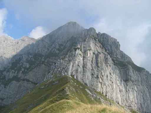 photo 20
 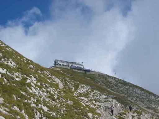 photo 21
  photo
22
photo
22
Time of distance 3-4 hours from Grignetta to Grignone
Turning to us we can see again the covered road, the crest of the Pertusio, the Rosalba shelter, the Segantini crest and the Traversata Alta.
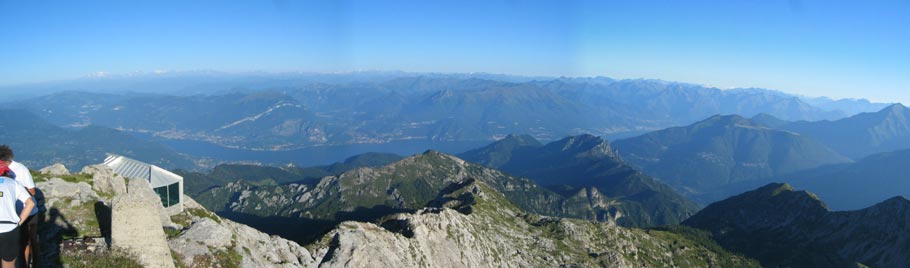
The Brioschi shelter is placed on the higher top of the group and dominates on the Brianza and Milan lands.
In particularly limpid days can be seen well Milan, Novara and the look can be pushed to south till the Monviso and the first Appennines. (winter photo 22 to the sunset, photo 23)
 photo
23
photo
23
To east, north and the west catch a glimpse tops of all the alpine arc: group of the Adamello, group of the Disgrazia, group of the Bernina, group of Rose etc
On the summit, a some thirty of meters over the shelter, camps an imposing cross that dominates the stony below goes them of the snowfild valley and, to the left the crest of Piancaformia that we will cover the next day.
The shelter, managed from Fulvio, pleasant and is optimally equipped.
Near the shelter there is a glass little chapel dedicated to the Virgin. (photo 24)
Third feature (Piancaformia crest, Pilastro-Grottoni-Enghen-Tagliata crest, Bronte crest)
Time of distance 6 - 8 hours
unevenness nearly 2000 meters
development of approximately 12 Km nearly all in reduction.
It is opportune to leave soon, not after the seven, and with a good escort of provisions and above all of water because we will not find sources for all the distance.
We leave from the little chapel.
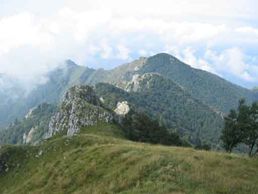
Most expert, going towards the north-west they cover all the crest of Piancaformia; it introduces some alpine difficulty not equipped (trail sign 19)
Less expert can come down in the canyon gravelly towards north and walk along the obvious normal trail (25) that coast to the feet of the crest till a trail sign (N45 57 21,2 E9 23 04,8 - 2220 m above sea level) that filler in crest in the terminal easier part of the crest.
On the left we let the Sasso Cavallo with the Bietti-Buzzi shelter of the CAI Mandello, completely restructured, and then the Prada and Calivazzo valleys, to right we can see the window of the Zapel, the tops of the Palone and under of we the Bogani shelter of the CAI Monza and the Mulini valley that come down until in Valsassina. (photo 25 and 26)
 photo 24
 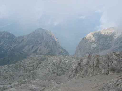 photo 25
  photo 26
The trail 19 for rocks and grass comes to the church of Prada (N45 58 11.5 E9 21 53.0 - 1638 m above sea level) dedicated to the 89 th Brigade Garibaldi.
A room in the back can serve as shelter in case of bad weather.
A lawn calls for a stop to rest and smoothly. (photo 27)
Start continuing on the path 24 to the blower of Prada (N45
58 14.3 E9 21 45.9 - 1621 m above sea level) and from there take
the path 17 for Mount Pilastro (N45
58 18.0 E9 21 21.9 - 1832 m above sea level) and then to the 17d
to the Calivazzo blower.
(N45 57 33.5 E9 20 35.4 - 1432 m above sea level)
The area is completely wild; left can see the ridges covered in previous days, (photo
28) to right the landscape stretches out on Como and Lecco Lake and Switzerland
(photo 29) in front of us that we crest. (photo 30)
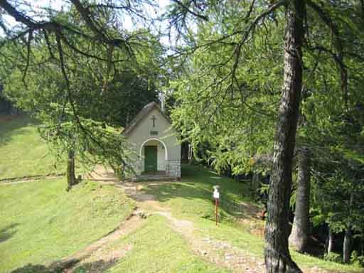 photo 27
 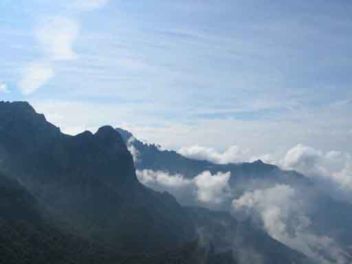 photo 28
 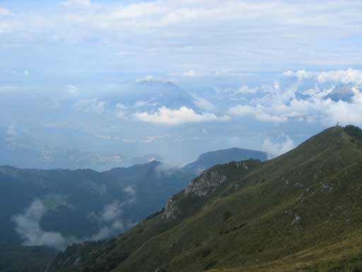 photo
29
photo
29
 photo
30
photo
30 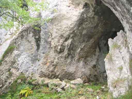 photo 31
Meet some chain, but nothing difficult, serving mainly in winter with snow.
Be careful not to lose sight of the stamps red marker placed on trees and rocks!
Because, despite their beauty, these paths are not very popular, it is easy,
especially in advanced season, are hidden by grass and plants and requires a
little patience to find the path.
In principle the rocks posing difficulties are bypassed on the right.
In particular, past a large cave (31 photos of the area Grottoni) down a stretch
of valley with grass and bushes, there are red stamps little obvious.
Taken the valley to the left of the ridge, we must stay on the right side of the
valley itself and go under a rock
(N45 57 54.0 E9 21 06.9 - 1593 m above
sea level), the path reappears sharp and flat shortly after and
leading until the blower-crossroads of Calivazzo.
(N45 57 33.5 E9 20 35.4 - 1432 m above
sea level).
 photo
32
photo
32
 photo
33
photo
33 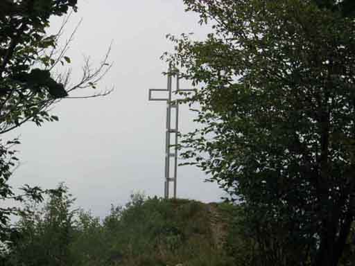 photo 34
Accompanies us on the right the Esino / Ortanella valley
(photo 32) and left the Era valley (photo 33).
We continue on the path 17d for the Verdascia blower
(N45 56 55.0 E9 20 18.0 - 1257 m above
sea level) and from there rose to the Zucco Sileccio.
Just above the top there is a lookout (photo 34) (N45 56 39.9 E9 20 15.6 - 1345 m above sea level), with a great cross of stainless steel, which offers a panorama truly exceptional. (photo 35)
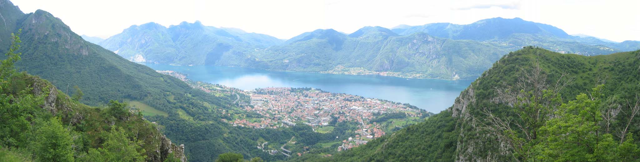 photo 35
You can almost all see also the run of the "rondò" (photo 36)
 photo
36
photo
36
From the cross back a few dozen meters up the junction with
trail path and take the rail 17a (Somana - Mandello).
We reach a ruin of tool
(N45 56 47.1 E9 20 12.2 - 1307 m above sea level) where we should
definitely turn left (going right return to the Verdascia blower).
The trail leads without further trouble Somana.
We must be careful when it comes to a large wooded ridge without trail path;
trail, narrow, but clear, it takes just to the left
(N45 56 23.4 E9 19 42.9 - 891 m above
sea level) down to the valley and then to Somana.
(N45 55 52.9 E9 19 37.6 - 380 m s.l.m.)
**********************************
Those who had chosen to walk back to square one (Rongio)
must take the carrareccia that starts near a fountain wash
(N45 55 53.0 E9 19 40.2 - 383 m above sea level) and entering the
valley of the river Meria.
Reached a crossroads with marker
(N45 55 51.2 E9 19 52.3 - 370 m above
sea level) must take the little trail right (nature trail) down to
the valley floor, cross the bridge over the river and up the opposite side of
the valley to a steep asphalt road that leads to the point.
(N45 55 39.4 E9 19 49.7 - 403 m s.l.m.)
**********************************
Conclusion
The effort is largely compensated by the magnitude and variety of landscapes
that occur as they move.
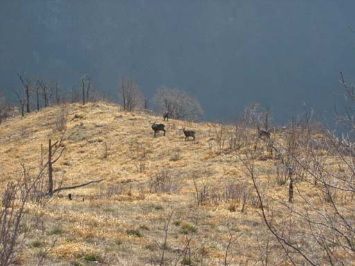
We live three days of paradise. Not missing flowers and animals.

For more information contact the group leader Corvi
Luciano Colombo tel. 3343221204
e-mail colluc@colluc.it
We have available the file to track the GPS in version for experts as in easier
version.
We would appreciate comments and ratings from those who runs the "Rondò
delle creste".